On Saturday at 4:51 p.m. an updated severe thunderstorm warning was issued by the National Weather Service valid until 5:30 p.m. for Calhoun, Cherokee and Etowah counties.
Updated: Aug. 17, 2024, 5:00 p.m."At 4:51 p.m., a severe thunderstorm was located near Ball Flat, or near Hokes Bluff, moving east at 35 mph," states the weather service. "Expect damage to roofs, siding, and trees."
When venturing outdoors, it's vital to establish a clear plan for seeking shelter in case of lightning. If you find yourself outdoors without access to indoor shelter during a thunderstorm, take these steps to maximize your safety:Steer clear of tall, isolated trees and other prominent objects. In wooded areas, stay close to lower stands of trees.
Do not approach water bodies, wet objects, or metal items. Although water and metal do not attract lightning, they conduct electricity effectively and can pose significant risks. If the roadside is your only option, pull off as far as possible, preferably past the end of a guard rail, and wait until the storm passes. Keep your headlights on and turn on emergency flashers to alert other drivers of your position.
@Exmeter Weather Alerts @Exalerts @River-State
South Africa Latest News, South Africa Headlines
Similar News:You can also read news stories similar to this one that we have collected from other news sources.
 Thunderstorms with penny-sized hail and damaging winds in North Alabama SaturdayThe National Weather Service issued a severe thunderstorm warning at 1:29 p.m. on Saturday valid until 2:15 p.m. for Lawrence, Limestone and Morgan counties.
Read more »
 Update: Expect damaging winds and penny-sized hail with thunderstorms in Shelby County SaturdayOn Saturday at 4:23 p.m. an updated severe thunderstorm warning was issued by the National Weather Service valid until 5 p.m. for Shelby County.
Read more »
 Update: Thunderstorms with penny-sized hail and damaging winds in Chilton and Coosa counties SaturdayOn Saturday at 4:35 p.m. the National Weather Service issued an updated severe thunderstorm warning valid until 5 p.m. for Chilton and Coosa counties.
Read more »
 Update: Thunderstorms with penny-sized hail and damaging winds in Erie County SaturdayOn Saturday at 2:53 p.m. an updated severe thunderstorm warning was issued by the National Weather Service valid until 3:15 p.m. for Erie County.
Read more »
 Update: Penny-sized hail and damaging winds anticipated with thunderstorms to hit Jackson County SaturdayThe National Weather Service issued an updated severe thunderstorm warning at 1:41 p.m. on Saturday valid until 2 p.m. for Jackson County.
Read more »
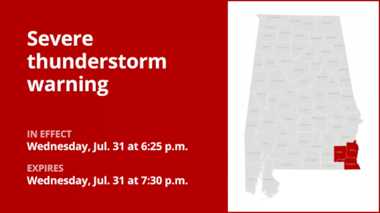 Update: Quarter-sized hail and damaging winds anticipated with thunderstorms in Southeast Alabama WednesdayOn Wednesday at 6:25 p.m. the National Weather Service issued an updated severe thunderstorm warning valid until 7:30 p.m. for Dale, Henry and Houston counties.
Read more »