Temperatures remain moderate for the first half of the week, with a gradual warming pattern on Thursday.
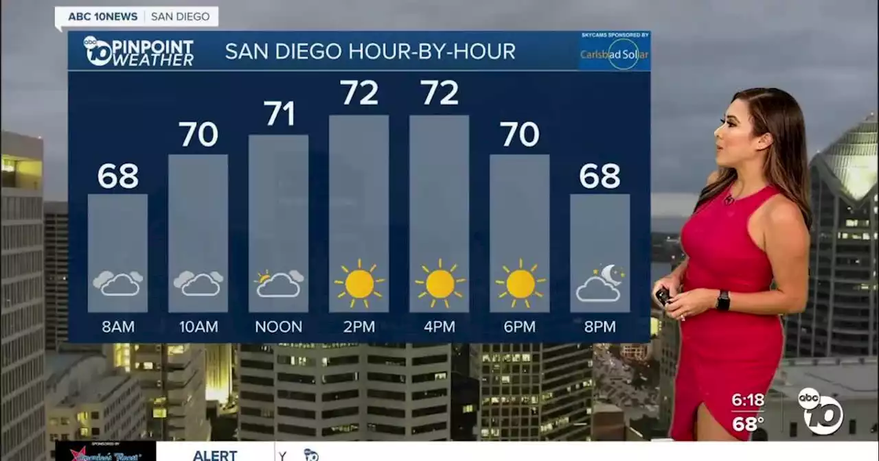
As we kick off a new workweek, dense marine layer clouds continue to provide drizzle and light shower activity across the coastal and inland communities, saturating some of our roadways. Leave time for travel as you head out.
Following a spooky October-like weekend, we'll have better clearing this afternoon, leading to warmer temperatures across the county, especially in the mountains and deserts. This past weekend was so cold we broke records for the coolest daytime highs in areas like Ramona and Vista. The marine layer will stick around each morning this week as a low-pressure system sits parked off the west coast. That system will move inland Wednesday, ramping up winds with isolated gusts up to 60mph in wind-prone neighborhoods along the foothill and mountain communities. Meanwhile, we'll have a nice sea breeze west of the mountains.
Autumn equinox falls on Friday at 11:50 p.m. Expect a warm and average start to the new season with daytime highs in the upper 70s, low 80s from the mountains to the coast, and upper 90s in the deserts.For the latest news, weather and traffic updates, follow Vanessa Paz on Facebook, Twitter and Instagram.
South Africa Latest News, South Africa Headlines
Similar News:You can also read news stories similar to this one that we have collected from other news sources.
 Weather for last week of summer in San Diego: Clouds, drizzleLow clouds, patchy drizzle and cooler temperatures are how San Diego County denizens are starting off the last week of summer. Fall officially starts on Saturday, Sept. 23.
Read more »