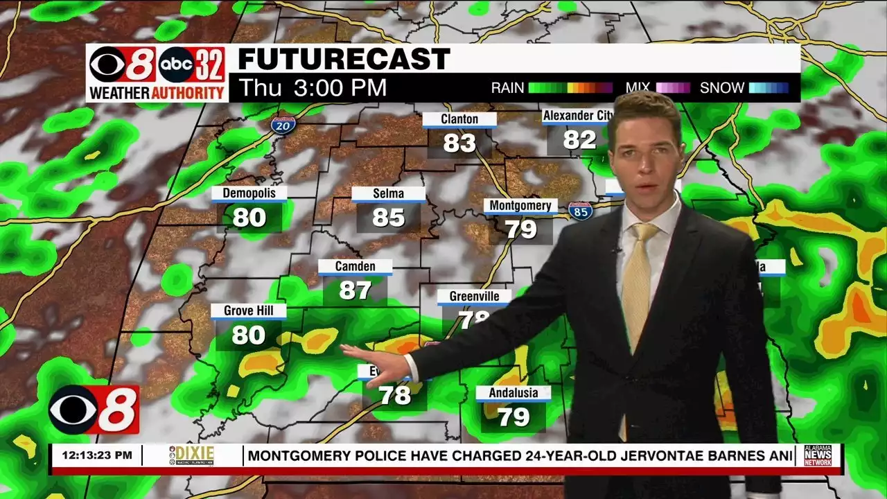
Numerous storms may cover central and south Alabama Thursday afternoon.
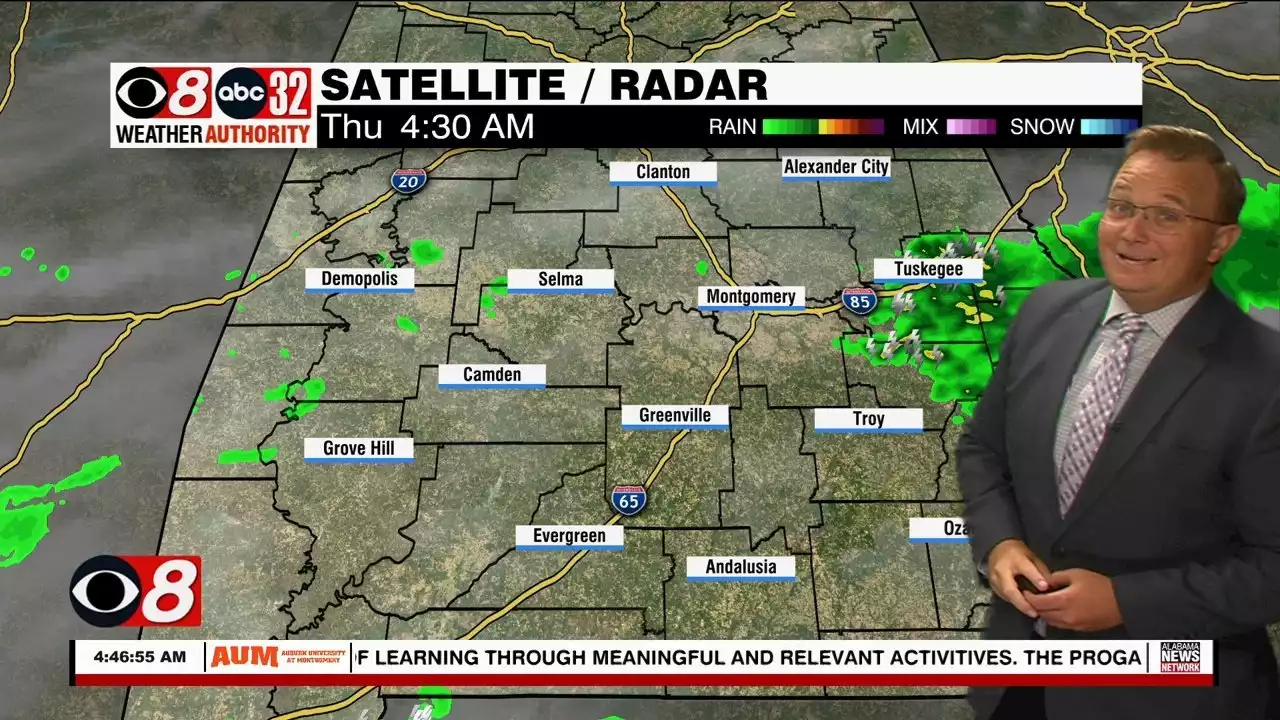
Thursday morning’s weather was unpleasant across much of the river region. Torrential rain fell for several hours near I-85 from Montgomery east to near Auburn. Rain totals measured between 3 and 4 inches in some locations there. Fortunately, rain largely tapered off along I-85 in east Alabama by midday. However, numerous storms may cover central and south Alabama during the afternoon.
At midday, new storms producing heavy rain focused along highway 84 in west Alabama. While not severe, these storms were also producing heavy rain and frequent lightning. The storm prediction center removed southeast Alabama from a marginal risk area for the rest of the day. Storms likely remain sub-severe Thursday afternoon, but could still produce strong wind gusts and heavy rain.
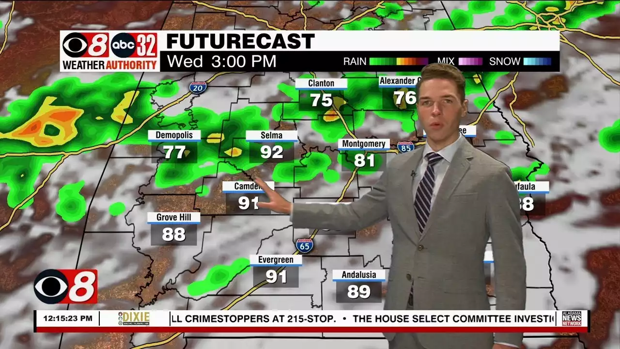
With any luck, storms wind down during the evening and stay away overnight through Friday morning. Although, the sky likely remains mostly cloudy, with lows in the low to mid 70s. Scattered storms develop Friday afternoon through early evening. Rain coverage may remain a bit lower compared to Thursday. Outside of storms, the sky remains partly cloudy on average with highs in the low 90s.
The rain chance looks lower, but not zero this weekend. Only isolated showers or storms form Saturday afternoon. Most locations see quite a bit of sunshine throughout the day. Storms may become a bit more widely scattered again Sunday afternoon. However, some locations still remain dry. Temperatures peak in the low 90s each afternoon.
Showers and storms become scattered to numerous next Monday and Tuesday afternoon. The rain chance may drop a bit Wednesday, then increase again Thursday. Continued healthy rain chance each day next week keep the afternoon heat in check. Temperatures peak in the low 90s each afternoon for most locations. However, some spots may feel mid-90° heat towards the end of next week.
South Africa Latest News, South Africa Headlines
Similar News:You can also read news stories similar to this one that we have collected from other news sources.
 A Few Strong To Severe Storms Possible Wednesday - Alabama NewsStorms ultimately become scattered to numerous Wednesday. A few storms may become severe, capable of damaging winds up to 60 mph.
Read more »
 D.C.-area forecast: Lower storm chances the next few days with seasonable heatAny showers or storms should stay isolated until a rising chance of storms this weekend.
Read more »
 Rain & Storms With A Tropical Connection - Alabama NewsPeriods of rain and storms south and eastward this evening. Areas north and west are looking a bit drier. A broad area of low pressure over the northern gulf is transporting moisture into the area. Tropical like showers and storms are likely and some storms will produce heavy rain, gusty winds, and frequent lightning strikes. We expect the rain/storm activity...
Read more »
 Daily Rounds Of Showers & Storms Ahead - Alabama NewsAbundant tropical moisture sits over us and just to our north is a frontal boundary. This has become the recipe for periods of rain and storms. We see storms lingering into the evening and early morning hours before weakening and fading away. We get another round of these storms Thursday. Any of the storms will be capable of heavy downpours,...
Read more »
 Another Wet and Stormy Day for Much of Central and South Alabama - Alabama NewsWe have a stalled boundary in place across Central Alabama and it will continue to be the focal point for rain and storms today.
Read more »
 Another hot day for metro Denver with scattered afternoon stormsThursday will be hot again and mostly dry with highs in the mid-upper 90s for lower elevations and in the 70s to low 80s in the mountains. Thunderstorms will develop in the afternoon and evening.
Read more »