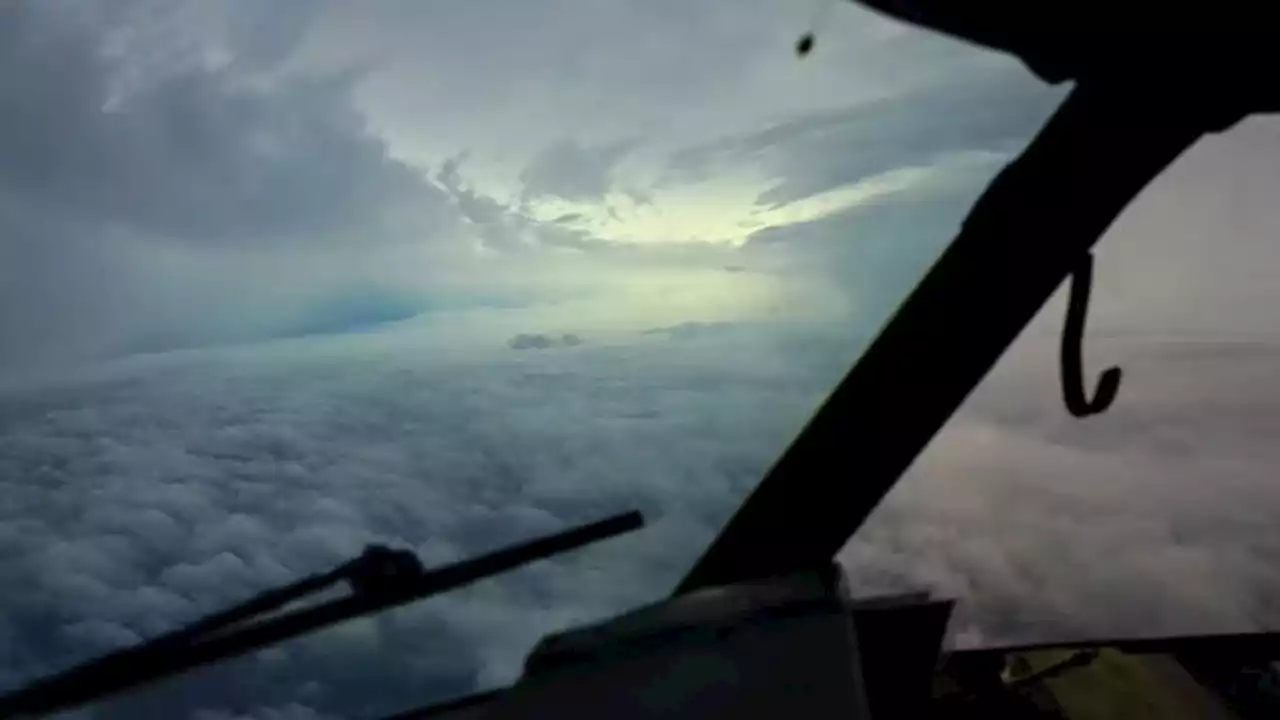
Scientists on planes flying through Hurricane Ian's center are taking measurements satellites can’t and sending them to hurricane forecasters.
Flying into Hurricane Harvey aboard a a P-3 Hurricane Hunter nicknamed Kermit in 2018. Lt. Kevin Doreumus/NOAA
In the P-3s, we routinely cut through the middle of the storm, right into the eye. Picture an X pattern — we keep cutting through the storm multiple times during a mission. These might be developing storms, or they might be Category 5s. When we were coming through the eyewall of Dorian, it was all seat belts. You can lose a few hundred feet in a couple of seconds if you have a down draft, or you can hit an updraft and gain a few hundred feet in a matter of seconds. It’s a lot like a rollercoaster ride, only you don’t know exactly when the next up or down is coming.At one point, we had G-forces of 3 to 4 Gs. That’s what astronauts experience during a rocket launch.
Listen now and subscribe: Apple Podcasts | Google Podcasts | Spotify | RSS Feed | Omny Studio A hurricane hunter flies through Hurricane Ida in 2021. Lt. Cmdr. Kevin Doremus/NOAA Corps A storm that isn’t yet fully together might have low-level circulation, a few kilometers above the ocean, that isn’t lined up with its mid-level circulation 6 or 7 kilometers up. That isn’t a very healthy storm. But a few hours later, we might fly back into the storm and notice that the two centers are more lined up. That’s a sign that it could rapidly intensify.
What instruments do you use to measure and forecast hurricane behavior?We need instruments that not only measure the atmosphere but also the ocean. The winds can steer a storm or tear it apart, but the ocean heat and moisture are its fuel. If you have warm ocean water that’s maybe 85 F at the surface, but just 50 feet down the water is quite a bit colder, the hurricane is going to mix in that cold water pretty quickly and weaken the storm. But deep warm water, like we find in eddies in the Gulf of Mexico, provides extra energy that can fuel a storm.
South Africa Latest News, South Africa Headlines
Similar News:You can also read news stories similar to this one that we have collected from other news sources.
 Hurricane Ian live updates: Category 3 storm makes landfall in Cuba as Florida braces for impactHurricane Ian strengthened early Tuesday into a major Category 3 storm as Florida and Cuba braced for strong winds and possible floods.
Read more »
 Hurricane Ian strikes Cuba, strengthens to Category 3 as it targets FloridaHurricane Ian strengthened to a major hurricane Tuesday and has reached maximum sustained winds of 125 mph. The storm made landfall in Cuba and is now a Category 3.
Read more »
 Hurricane Ian now a Category 3 storm, bringing storm surges to Florida’s west coastHurricane Ian’s sustained winds intensified to around 125 mph early Tuesday morning as the storm strengthened to a Category 3 hurricane, making landfall in western Cuba.
Read more »
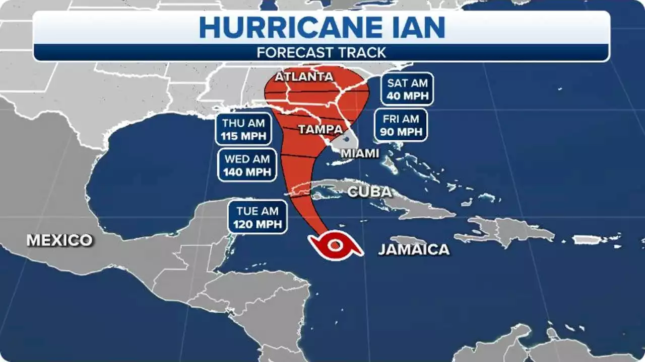 Hurricane Ian forms in Caribbean, prompting Hurricane Watch for Florida's Gulf Coast, including Tampa BayA Hurricane Watch has been issued along Florida's Gulf Coast ahead of the expected wind, rain, and storm surge from Hurricane Ian later this week.
Read more »
 Tropical Storm Ian's uncertain path has all of Florida preparing for a major hurricaneIts exact path still uncertain, Tropical Storm Ian strengthened Sunday night as it churned in the Caribbean, threatening to arrive in Florida as a hurricane packing powerful winds and dangerous storm surge.
Read more »