This past week's front brought calm weather for our weekend, but what does tomorrow's front have in store? alwx
SATURDAY: Our Saturday has been filled with plenty of sunshine and drier air as a result from yesterday’s cold front. Temperatures have hovered in the mid 80s across the area, and there’s hardly been a cloud in the sky! For the evening, a cool night is expected with lows in the low 60s and upper 50s.
SUNDAY: Another front will be approaching the area tomorrow, and that will bring a cloudy start to our Sunday with a slight chance for some showers and storms. Clouds and sunshine will mix throughout the day, and the chance for rain will dissipate into the evening. Highs will be in the mid to upper 80s.
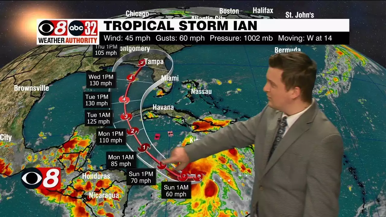
WEEK AHEAD: Tomorrow’s front will bring a very nice week of weather. Temperatures will be in the low 80s for the majority of the week, with lows in the mid to upper 50s for some days. Rain chances will be staying minimal until we approach the weekend, as some tropical mischief will be in play. TROPICAL TROUBLE: Current Tropical Storm Ian is forecast to become a Major Hurricane by mid week, but its end location is still questionable. As of now, the National Hurricane Center has the cone of uncertainty missing our area, but models are not in agreement with where Ian will end up. The GFS has a major hurricane making landfall Friday morning near Destin, while the Euro model has a major hurricane making landfall in the peninsula of Florida.